
近日,清华大学阳坤团队揭示了地表反照率关键参数优化减少青藏高原气候模拟的湿偏。相关论文发表在2025年7月17日出版的《中国科学:地球科学》杂志上。
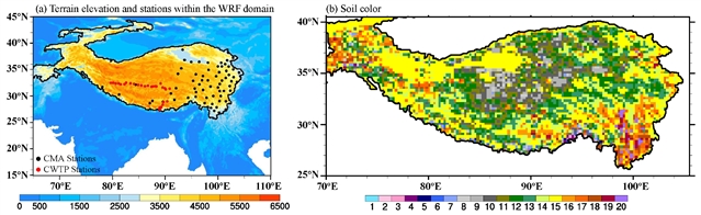
地表反照率在调节地表能量收支从而调节陆地-大气相互作用中起着关键作用。大多数陆地表面模式使用所谓的土壤颜色参数来确定干/饱和土壤的反照率,但在天气研究与预报(WRF)模式中,该参数的特征很差,导致对青藏高原(TP)夏季地表反照率的低估。
研究组引入了一种优化的土壤颜色图,可以有效地增强10年气候模拟周期内地表反照率和地表温度的模拟。这种改善减少了TP的热效应,同时减少了夏季的净辐射、潜热和感热,导致对流层低层位势高度增加和水汽通量辐合减少。与IMERG和GSMaP产品相比,由此得出的降水估算结果显示湿偏差减少(52%至36%)。
对雨量计观测的进一步评估表明,纳入优化的土壤颜色图改善了66%站点的降水模拟,平均湿偏差从1.02减小到0.82 mm d-1。研究结果表明,地表反照率的低估是降水模拟中湿偏的部分原因。通过优化地表参数来改进气候模型的可行性,通过地表模型和卫星遥感产品的联合主题,这是非常经济实惠的。
附:英文原文
Title: Optimization of key land surface albedo parameter reduces wet bias of climate modeling for the Tibetan Plateau
Author: Xiaogang MA, Long ZHAO, Jing SUN, Jinyan CHEN, Yan WANG, Jianhong ZHOU, Jiarui LIU, Hui LU, Kun YANG
Issue&Volume: 2025/07/17
Abstract: Land surface albedo plays a key role in regulating surface energy budgets and thereby land-atmosphere interactions. Most land surface models employ a so-called soil color parameter to determine albedos for dry/saturated soils, yet it is poorly characterized in the Weather Research and Forecasting (WRF) model, leading to an underestimation of summertime surface albedo on the Tibetan Plateau (TP). This study introduces an optimized soil color map, which can effectively enhance the simulation of surface albedo and land surface temperature over a 10-year climate modeling period. This improvement reduces the TP’s thermal effect, along with decreased net radiation, latent, and sensible heat during the summer, leading to an increase in geopotential height in the lower troposphere and a reduction in water vapor flux convergence. The resulting precipitation estimation shows a reduced wet bias (52% to 36%), as compared with IMERG and GSMaP products. Further evaluation against rain-gauge observations suggests that the incorporation of an optimized soil color map improves precipitation simulation at 66% of the stations, with mean wet bias mitigated from 1.02 to 0.82mmd1. The findings reveal that the underestimation of surface albedo is partially responsible for the wet bias in precipitation simulation. It also highlights the feasibility of improving climate modeling by optimizing land surface parameters, which is highly affordable through the joint use of land surface models and satellite remote sensing products.
DOI: 10.1007/s11430-025-1635-0
Source: https://www.sciengine.com/SCES/doi/10.1007/s11430-025-1635-0
Science China Earth Sciences:《中国科学:地球科学》,创刊于1952年。隶属于施普林格·自然出版集团,最新IF:5.7
官方网址:https://www.sciengine.com/SCES/home
投稿链接:https://mc03.manuscriptcentral.com/sces